Mars volcano Tharsis Tholus collapsed at least twice, leaving a pit nearly 3 km deep
Mars Express has imaged Tharsis Tholus, a modest Martian volcano about 8 km tall whose summit shows two collapses, each leaving a pit nearly 3 km deep.
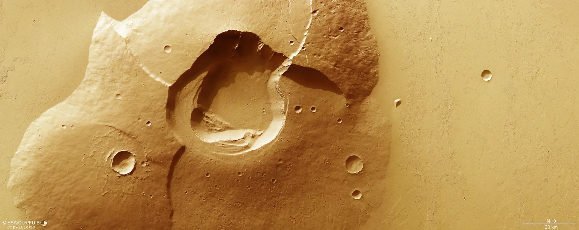
ESA’s Mars Express orbiter has returned a new image of Tharsis Tholus, a Martian volcano about 8 km tall whose summit collapsed at least twice. The two resulting pits, called calderas, are nearly 3 km deep.
Two collapses in one summit
A caldera forms when a volcano empties its underground chamber of magma, the molten rock beneath it. The rock above is left unsupported and can fall in. ESA says the volcano carries evidence of two separate collapses: an older caldera on the outside and a younger one nested within it.
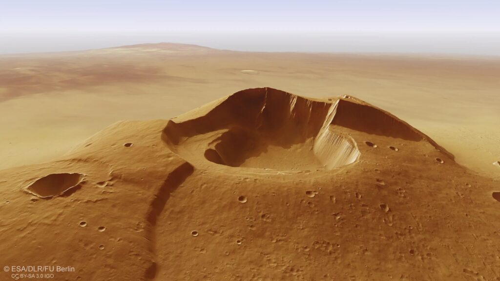
Both are unusually large for a volcano of this size, according to ESA. The agency also reports small gullies along the rim and the steep inner walls, plus signs of landslides. Both are made by loose rock sliding down into the central pit.
The flanks tell a longer story. They were built up from surrounding lava flows and have since been hit by impacts and reshaped by other geological processes. ESA identifies several steep cliffs, likely formed as the heavy volcano pressed on softer layers below and warped its structure. Cracks cross the flanks too: faults, where the crust has stretched and broken, and grabens, strips of land that dropped between two faults.
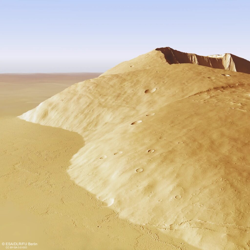
According to ESA, construction of the volcano started roughly 3.8 billion years ago, and its most recent lava output is estimated at around 200 million years ago, which counts as recent on a geological clock. The slopes rise at 10 degrees from level ground, placing it among the steeper volcanoes on Mars. ESA says that is more than Earth’s Mauna Kea but less than Vesuvius.
How the picture was made
The image comes from the High Resolution Stereo Camera (HRSC), one of eight instruments on Mars Express, which launched in 2003. The camera was developed and is operated by the German Aerospace Center (DLR), and its data were processed at the DLR Institute of Space Research in Berlin-Adlershof. A working group at Freie Universität Berlin produced the image products.
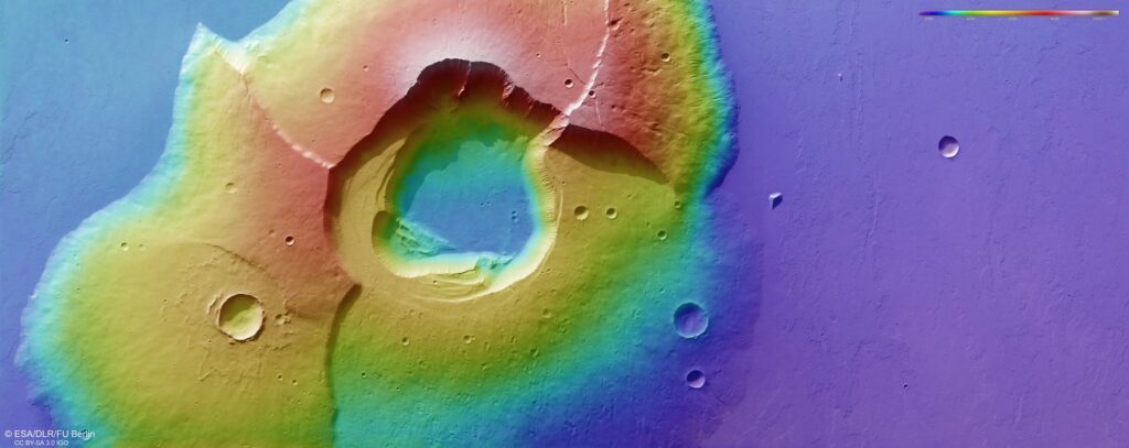
The pass over Tharsis Tholus, orbit 28331, carried no color data. ESA says the released images borrow color from two other orbits, 17050 and 17444. The 3D perspective views are built from a digital terrain model, a height map of the ground, and the camera’s nadir (straight-down) and color channels. Their vertical scale is exaggerated three times so the relief is easier to read.
A small volcano by Martian standards
Tharsis Tholus is easy to overlook in a region that holds the Solar System’s biggest volcanoes. ESA puts the height of Olympus Mons at nearly 22 km, over twice Mount Everest, and says Arsia Mons, Pavonis Mons and Ascraeus Mons are all taller than any mountain on Earth. At about 8 km, Tharsis Tholus stands at roughly a third of Olympus Mons, yet still matches the highest Himalayan peaks.
Measuring a mountain depends on where you start. NASA’s Mars facts page gives Olympus Mons as more than 25 miles (about 40 km) from base to summit, well above ESA’s figure, so the two numbers should not be compared directly without checking the reference point each uses.
The scale of the planet adds perspective. NASA lists Mars with a radius of 3,390 km, giving a diameter of about 6,780 km, roughly half of Earth’s. A planet that small still carries volcanoes several times taller than Earth’s. ESA’s explanation is a mix of low gravity, no active plate tectonics and little ongoing erosion, which lets a volcano sit over its magma source for a very long time instead of being carried away or worn down.
Volcanism was widespread on Mars several billion years ago, ESA says, and any activity today happens at a far lower rate. ESA notes that its other Mars orbiter reported such activity this month.
For more pictures of the planet from rovers and orbiters, see our guide to the best Mars photos.