Sentinel-3C’s heat-sensing camera sees 40 °C Australian outback and Iberian burn scars
ESA has released the first heat images from the SLSTR radiometer on Sentinel-3C, showing land above 40 °C in Western Australia and fire scars in Europe.
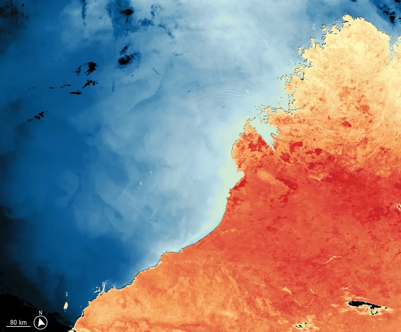
ESA has released the first thermal images from the radiometer on Sentinel-3C, an Earth-observing satellite that measures temperature from orbit. The pictures show land above 40 °C in Western Australia and burn scars in Spain and France, even though the instrument is still being commissioned.
According to ESA, Sentinel-3C launched on 15 September 2026 and carries four instruments. One of them is the Sea and Land Surface Temperature Radiometer, known as SLSTR. A radiometer is a sensor that measures the radiation, here light and heat, coming up from the ground and sea. ESA says the thermal and shortwave infrared channels have now been switched on and that the instrument “is working well” even before full commissioning, the testing period that comes before a satellite starts regular service.
A hot Kimberley and a cooler Indian Ocean
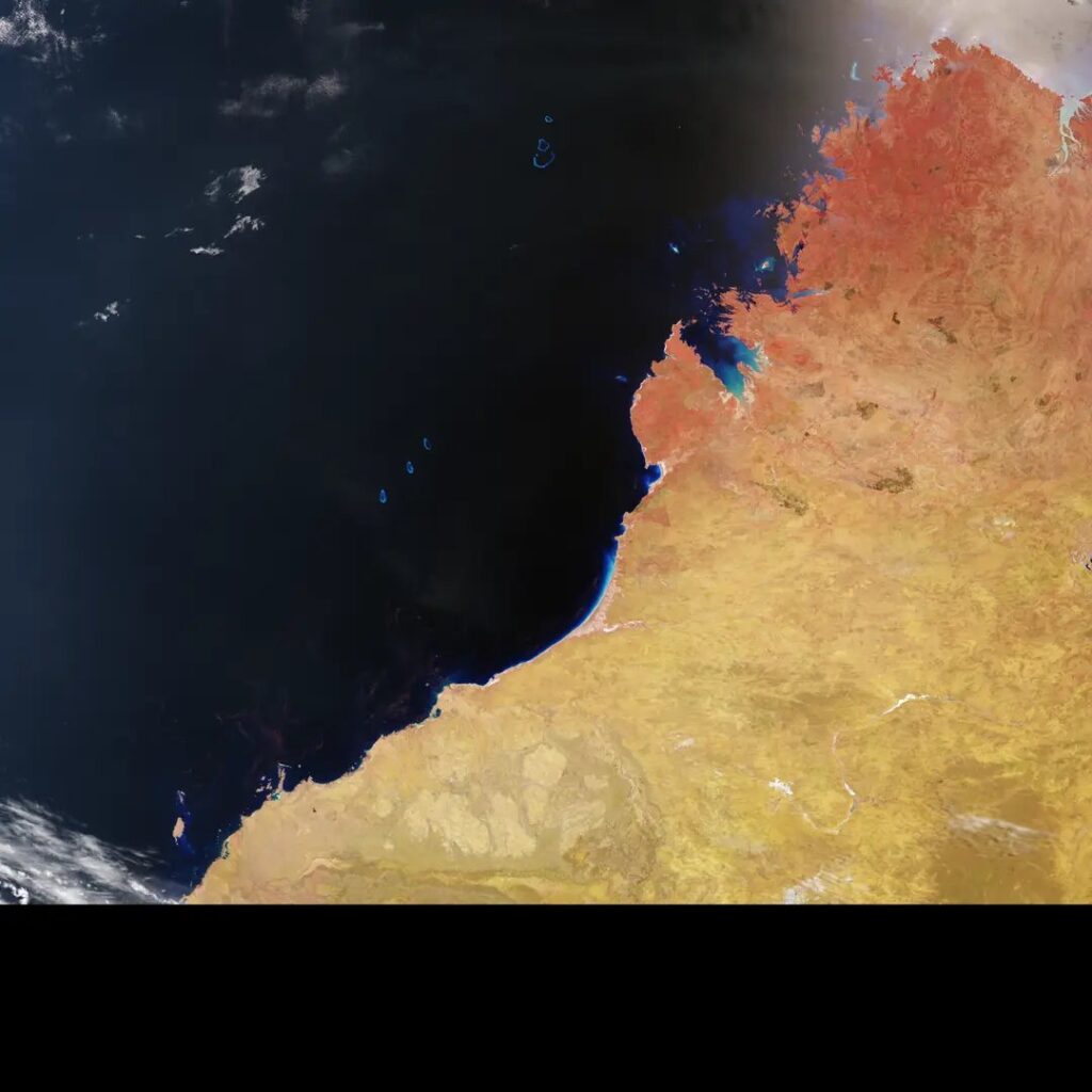
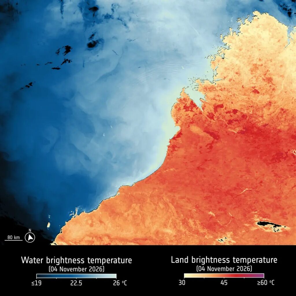
The first scene was captured on 4 November 2026 over Western Australia. It covers the Kimberley region, Broome, the Dampier Peninsula and the Rowley Shoals. Land in the lower part of the image is above 40 °C, the northern coastal areas are 35 °C or less, and the eastern Indian Ocean is around 20 °C.
ESA points out that these are brightness temperatures measured at the top of the atmosphere. That means the satellite records the heat radiation reaching it, which can differ from the physical temperature of the ground. The region has had heatwaves and wildfires linked to El Niño, ESA notes.
A false-colour version of the same scene assigns visible and infrared bands to colors the eye can read easily. Vegetation appears in red tones, and burn scars show as dark brown.
Fire scars west of Madrid and near Bordeaux
The second set of images was taken on 2 November 2026 over southwestern Europe and North Africa. Southern Portugal and Andalusia are in the mid to high 20s °C, while parts of Morocco and northern Algeria exceed 30 °C. Burn scars are visible west of Madrid and near Bordeaux. In the false-colour view, bright green marks cooler, more densely vegetated ground.
ESA had already published images from the OLCI ocean and land colour instrument and from the satellite’s radar altimeter the previous month, so the radiometer completes the first look at Sentinel-3C’s main payload.
What the radiometer is built to deliver
The pictures are a demonstration, but the instrument has a defined job. According to ESA’s description of the Sentinel-3 instruments, SLSTR is designed to measure global sea and land surface temperature to better than 0.3 K (0.3 degrees Celsius) every day. It sees the ground at 500 meters per pixel in visible, near-infrared and shortwave infrared channels, and at 1 kilometer in the thermal infrared channels.
It scans each place from two angles along the satellite’s track. Viewing through two different lengths of atmosphere makes it easier to correct for the air’s effect on the signal, which is why the same design is used to produce precise temperature maps.
Who uses fire and temperature data
ESA says two of SLSTR’s thermal channels are meant for detecting active fires and measuring their fire radiative power, the amount of heat energy a blaze gives off. These data feed the Copernicus Emergency Response and Climate Services, according to ESA. For wildfire agencies and climate scientists, a second satellite carrying the same radiometer adds more passes over the same regions, which helps in tracking both a fire as it burns and the scar it leaves behind.
The Iberian and Australian scenes show both uses: heat in the thermal channel, and the damage left behind in the false-colour views. Both are the kind of product that emergency teams and ocean and climate researchers draw on. ESA has not yet said when Sentinel-3C will complete commissioning and begin routine data delivery.