Puncak Jaya’s tropical ice is down to 2% of its 1988 extent, NASA images show
Landsat images from 1988 and 2026 show the ice near Indonesia's Puncak Jaya reduced to scattered patches that no longer flow, with El Niño threatening what is left.
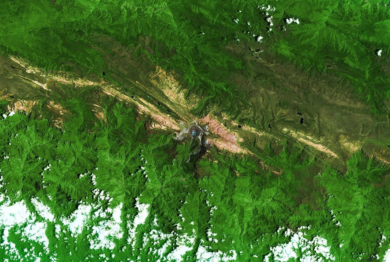
New NASA Earth Observatory satellite images show that the ice near the summit of Puncak Jaya in Indonesia has shrunk to scattered patches too small to flow like glaciers. By September 2025, about 0.09 square kilometers remained, roughly 2 percent of the 1988 area.
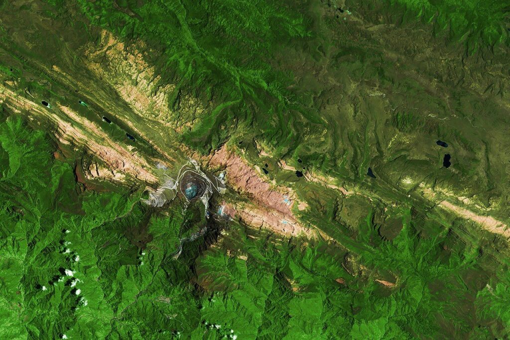
A 1988 and 2026 comparison from Landsat
The Sudirman Range on the island of New Guinea is one of the few places near the equator where ice has lasted year-round. NASA’s pair of images was taken by the Thematic Mapper on Landsat 5 in 1988 and by the Operational Land Imager on Landsat 9 in 2026. They are false-color pictures, which means the colors are chosen to separate surfaces: ice appears light blue, bare rock brown, vegetation green and clouds white.
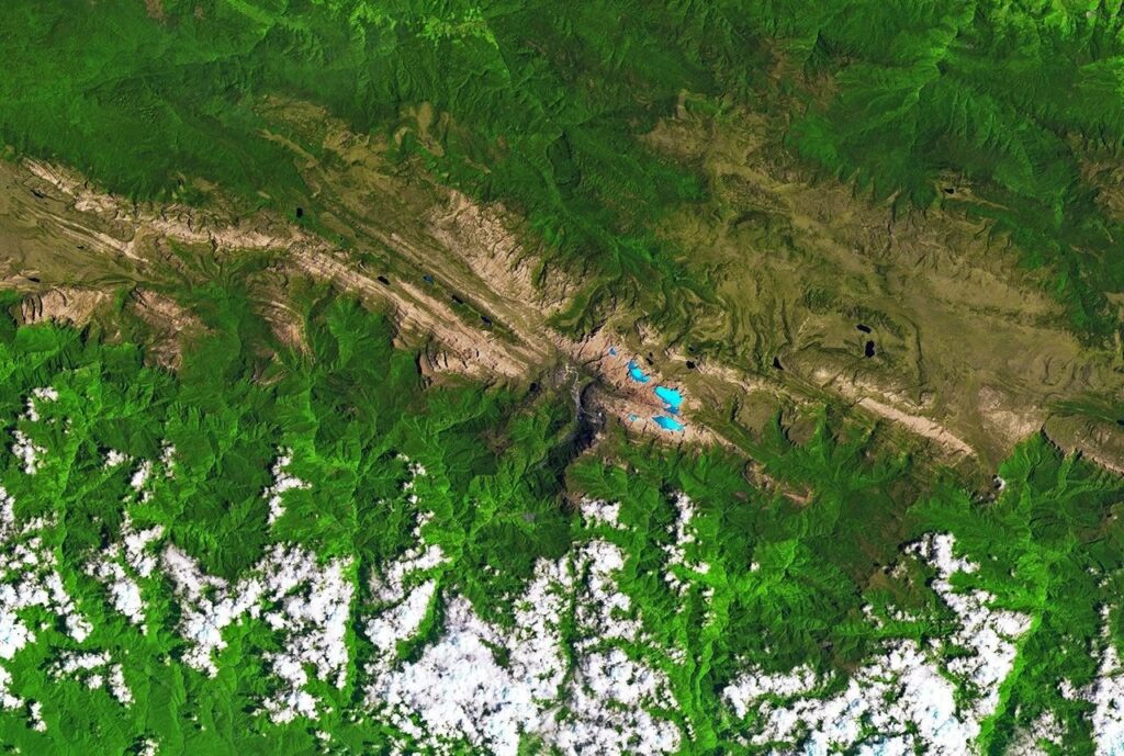
Donaldi Permana, a climate scientist at BMKG, Indonesia’s meteorology, climatology and geophysics agency, put the 1988 ice area at roughly 4.31 square kilometers (1.66 square miles). Satellite and aerial observations through September 2025 left only about 0.09 square kilometers (0.03 square miles), comparable to a dozen soccer fields. An aerial survey planned for December should give an estimate for 2026.
The ice has also thinned. At the main monitoring site on the East Northwall Firn (a field of old, compacted snow that feeds a glacier), thickness fell from 32 meters (105 feet) in 2010 to 4 meters (13 feet) in 2023. By November 2024, the ice there was gone.
Why the ice no longer counts as glaciers
To count as a glacier, ice must be heavy enough to creep downhill and must sit where snowfall outpaces melting. Puncak Jaya’s remnants have broken into small, stagnant patches that no longer flow. “While small ice remnants persist in high-altitude crevices around Puncak Jaya, their functional life as active glaciers is effectively over,” Permana said.
Each fragment adds exposed edges where ice can melt, so the losses compound. Snow still falls, but it does not last on bare rock long enough to turn into new ice. Chris Shuman, a retired University of Maryland glaciologist who has tracked the glaciers in satellite imagery, called it a “house of cards problem.”
El Niño and the clock on what remains
El Niño, a periodic warming of the tropical Pacific, hits these glaciers hard. Warmer air lifts the freezing level above the summit, so rain falls instead of snow. Less bright fresh snow means darker surfaces that absorb more heat. In the 2015-2016 event, thinning ran roughly fivefold above normal, with about 5.3 meters (17 feet) of thickness lost in a single year. The 2023-2024 event brought thinning of 2 to 4 meters (7 to 13 feet) per year.
Recent satellite studies suggest the main ice areas could vanish around 2030. Permana noted that BMKG estimates suggest it could be much sooner, hastened by the current El Niño.
A long-running decline, and a distant neighbor
Earlier NASA Earth Observatory coverage adds context. Puncak Jaya, the tallest peak in the Sudirman Range, rises 4,884 meters (16,020 feet) above sea level. In 1988 the mountain held five ice masses; by 2009 the Meren and Southwall glaciers had disappeared, and by 2017 the West Northwall Firn had gone too, according to NASA’s 2018 report.
That report also notes how isolated the range is: the nearest tropical glacial ice is on Mount Kenya in Africa, about 11,200 kilometers (6,900 miles) away. When the Puncak Jaya ice is gone, the western Pacific will have no tropical glaciers left to watch.
The December aerial survey is the next check. It should show how much of the 0.09 square kilometers survived this year’s conditions.