Virginia will plan its power grid with NASA’s weather and sunlight data
A new Space Act Agreement gives Virginia Energy direct access to NASA's solar, weather and future-risk datasets for grid resilience studies and long-term planning.
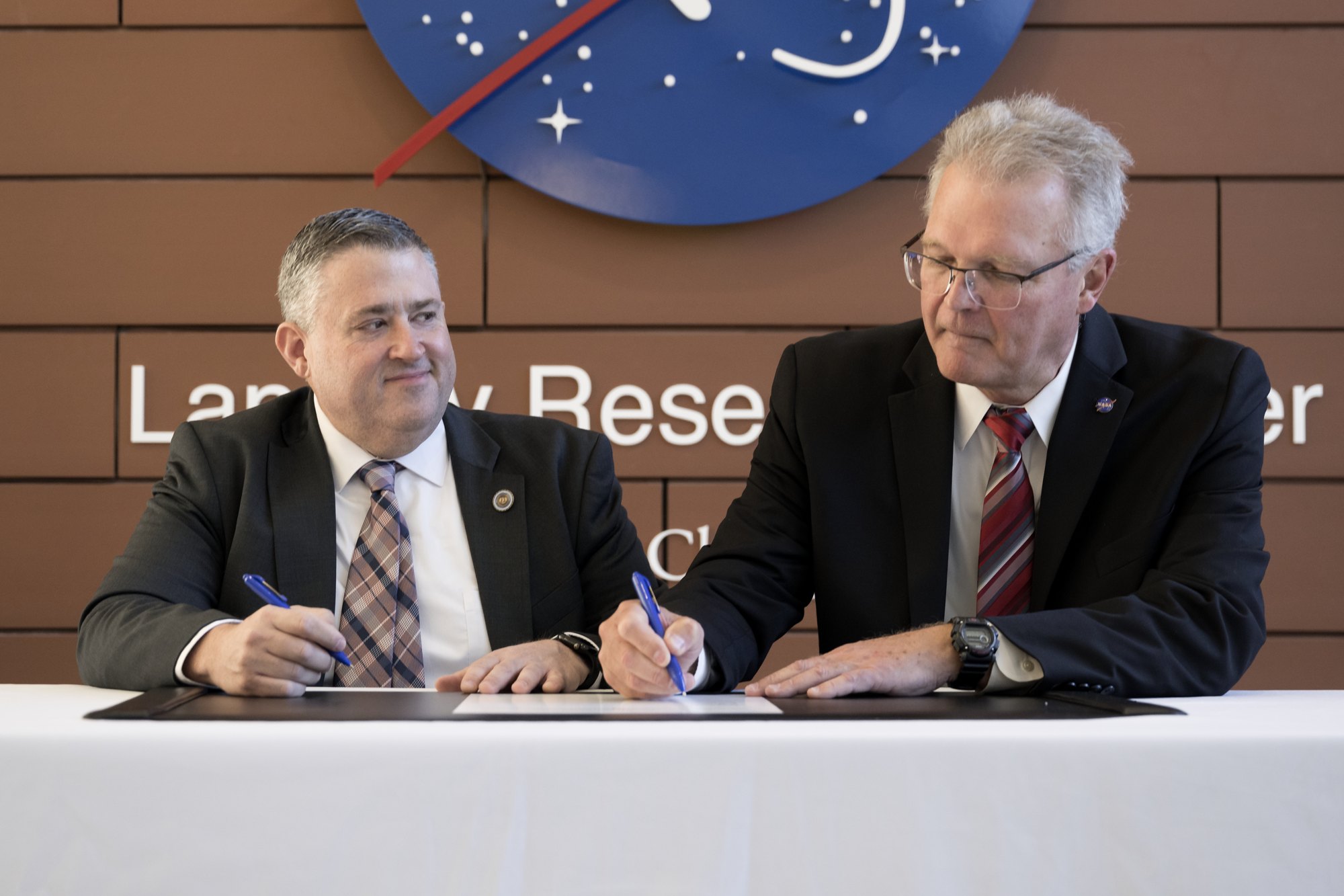
NASA’s Langley Research Center in Hampton, Virginia, and the Virginia Department of Energy signed a Space Act Agreement on Friday. Under it, NASA will supply solar, weather and future weather-risk data for the state’s energy planning.
A Space Act Agreement is the legal form NASA uses to work with partners outside the agency, including state governments. This one was announced at a ceremony at Langley, where NASA Langley Deputy Director Allen Kilgore and Virginia Energy Director Vince Maiden signed it.
A direct data pipeline into the state’s models
Virginia Energy will use NASA’s atmospheric science expertise for resiliency studies, resource analysis and long-term energy planning. The data will help state officials plan for current and possible extreme weather and assess what it means for electricity demand, generation and system stress, according to NASA.
The data comes from NASA’s Prediction of Worldwide Energy Resources project, known as POWER. It covers the sunlight and weather conditions that decide how much electricity solar equipment can produce and how much power buildings need for heating and cooling. NASA says the products are validated and come from its Earth Science to Action program. They draw on work at Langley, at Goddard Space Flight Center in Greenbelt, Maryland, and at Ames Research Center in California’s Silicon Valley.
Virginia Energy will connect to Langley’s POWER web platform through a digital pipeline. It can download specific datasets and load them straight into its own modeling tools. NASA’s POWER team will work with Virginia Energy researchers to streamline the exchange, adjust file formats and judge whether more data is needed.
Mapping where Virginians need the most cooling
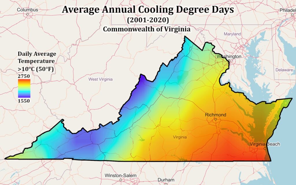
NASA released a sample map made with POWER data. It shows cooling degree days across the state, averaged over 2001 to 2020. A cooling degree day counts how far a day’s average temperature rises above a set threshold, so it indicates how much air conditioning is likely to run. In this map the threshold is 50°F (10°C). NASA says metrics like this, customized for the state, will help Virginia Energy understand demand and shape future plans.
“Sound energy planning depends on models that reflect real-world conditions,”
That was Maiden’s statement, as released by NASA. He added that the collaboration will help the department see how weather affects electricity supply and demand, identify vulnerabilities and weigh resource tradeoffs with more confidence. Kilgore said Langley wants to put its science data in the hands of people who can use it to improve lives, and that the work will give the Commonwealth stronger energy security.
NASA’s Strategic Partnerships Office at Langley set up the agreement. The office connects industry, academia and other government agencies with the center’s facilities, capabilities and technical expertise.
What is still open: How much the data will change decisions
The announcement is about access and method, not about a specific project or a funded program. Neither NASA nor Virginia Energy has said which studies will go first, how the datasets will be weighted against the state’s existing models, or what the agreement costs. NASA does not mention any payment, and it describes the data as being put into planning models, not into policy rules.
The 2001 to 2020 cooling-degree-day map also shows the basic limit of this kind of data. A 20-year average describes the past climate. The agreement also covers future weather-risk datasets, but NASA has not said which climate scenarios or models those will use. How well Virginia’s planners can turn that into grid decisions will depend on those choices.
The agreement does fit a wider pattern at NASA of turning Earth observations into practical tools. Our coverage of this year’s El Niño shows the same satellite record used to track a weather pattern that can change temperature and rainfall across regions. For a utility planner, those swings affect both how much power people use and how much solar and hydro supply is available.
For now the partnership gives one state a standing line to a global dataset that anyone can already browse on NASA’s POWER platform, with NASA staff on hand to adapt it. NASA says the aim is a more reliable and resilient energy system for Virginia.