NASA’s PACE satellite can now map autumn red across the whole planet
NASA's PACE satellite measures leaf pigments across the planet every day or two, and scientists are asking the public for ground photos to check what it sees.
NASA’s PACE satellite can track the pigments that turn leaves red, orange and yellow across the whole planet every day or two, NASA’s Earth Observatory reported. New maps show the 2026 wave of red moving south from the Arctic in early October.
How a satellite sees autumn color
PACE stands for Plankton, Aerosol, Cloud, ocean Ecosystem. Its main instrument, the Ocean Color Instrument (OCI), is hyperspectral: it splits light into 286 narrow bands of color instead of the few broad ones of an ordinary camera. NASA says some of those bands pick out three leaf pigments: anthocyanins (reds), carotenoids (yellows and oranges) and chlorophylls (greens).
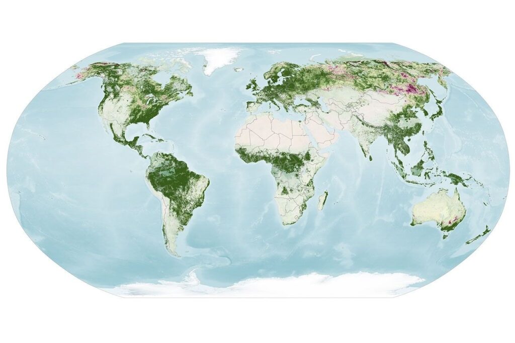
Scientists compare how much red, orange and yellow a forest shows against how much green. On the maps, a value near 1 means the satellite sees about as much red as green, so most leaves have not yet turned. Higher values, shown in light yellow and then red, mean more red pigment relative to green. Following that ratio week by week shows where leaves are changing and when color peaks.
Leaves change because chlorophyll, the green molecule plants use to make food, is unstable and has to be rebuilt constantly, which takes plenty of sunlight and warmth. As days shorten and temperatures fall, chlorophyll levels drop. The greens fade and the other pigments show through.
From the Arctic to the Mid-Atlantic in two weeks
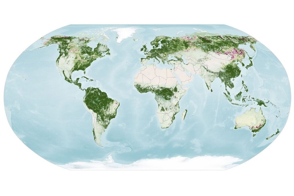
For September 29 to October 4, the highest redness values were in parts of northern and eastern Russia, northern Alaska and northern Canada. NASA says New England and upstate New York were also near their peak. Blueberries, bilberries, sedges, mosses and grasses likely add to the intense reds over marshy tundra.
By October 5 to 11, redness was fading in New England and upstate New York, even as it spread across much of the Midwest and the Mid-Atlantic. The reddest areas also shifted toward Mongolia and northern China.
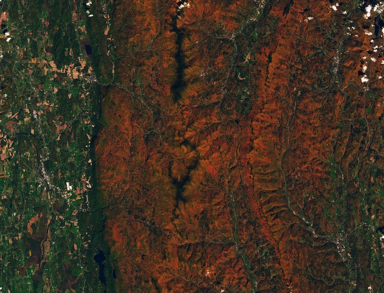
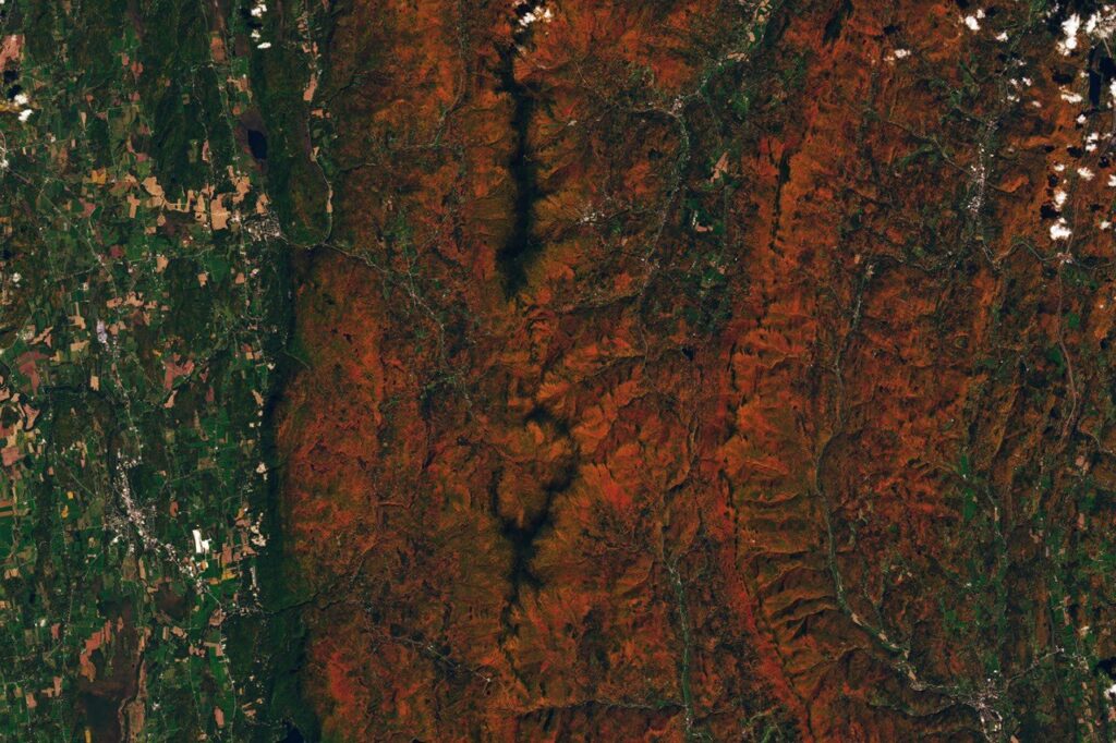
Landsat 9, a different NASA and U.S. Geological Survey satellite, gave a close-up. Its Operational Land Imager photographed the area around Ripton, Vermont, on October 3, 2026, around the regional peak. Ridges in the Green Mountains were orange and red, while river valleys and lower ground were still green.
NASA cautions that not every red patch on the maps is fall foliage. Crops show high anthocyanin levels as they ripen and after harvest, and clouds can leave apparent gaps.
What makes a daily global view unusual
Other hyperspectral satellites can measure these pigments, NASA says, but only over smaller areas and less often. According to the agency, PACE is the first to measure all three key pigments over the whole Earth every day or two. Karl Huemmrich, a vegetation scientist at the University of Maryland, Baltimore County and a PACE science team member, said the ability to collect repeated time-series data of anthocyanins and carotenoids everywhere on Earth is what changes things for the field.
The geometry explains why. NASA’s PACE mission page says the satellite flies in a sun-synchronous orbit (one that crosses each latitude at the same local time) about 676 km (420 miles) above Earth, circling in roughly 98.3 minutes. Combined with OCI’s wide swath, the strip of ground it sees on each pass, that lets the instrument cover high latitudes and the tropics alike on a short repeat cycle. That is the revisit rate needed to build the time series that pinpoints peak color anywhere.
The reach goes beyond leaf-peeping. The PACE team hopes the data will help show how the timing of spring greening and autumn leaf drop is shifting, how vegetation changes affect the global carbon cycle, and how leaf color relates to wildfire risk. Scientists also want to know whether PACE can catch early signs of drought, insect infestations and plant disease. Stressed plants can change pigments too, which NASA data scientist Skye Caplan said likely helps explain high redness in farmland in Brazil, Australia and Canada that does not follow the broader seasonal pattern.
Photos from the ground wanted
Caplan has been posting weekly foliage maps as part of the North American Phenology Campaign run by the GLOBE program (Global Learning and Observations to Benefit the Environment). They show red emerging at high latitudes in August and moving toward the equator through September and October.
To check the satellite readings, the PACE team is asking the public to send in photos of fall foliage. People in areas without dense forest can take part as well: scientists also want shrubs, grasses, wildflowers, evergreens and crops. Caplan’s advice for anyone planning a trip: “Color changes happen kind of slowly, then all at once, and then they’re gone.”