Fires have released a record 32 megatons of carbon in Papua New Guinea
NASA's Earth Observatory reports record fire emissions in Papua New Guinea and the third-highest ever on the Indonesian side, as El Niño drought and human-set fires fill the island with smoke.
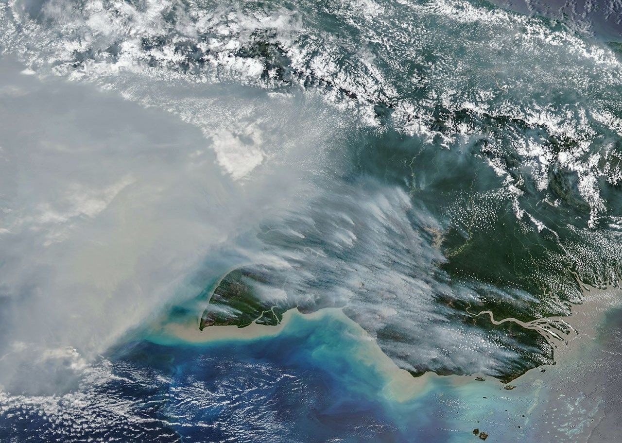
Fires on New Guinea, the world’s second-largest island, have released nearly 32 megatons of carbon in Papua New Guinea by October 19, more than in any previous year at that point, NASA’s Earth Observatory reported. Drought from a strong El Niño is driving the burning.
Smoke over the south, and a drought that lasted more than 90 days
El Niño is a climate pattern that shifts rainfall around the tropics, and this year it has left New Guinea unusually dry. The southernmost part of Papua New Guinea, the Trans-Fly region of savanna and grassland, went more than 90 consecutive days without rain, according to the country’s National Weather Service. Since August, parts of that region have received only about 5 to 10 percent of normal rainfall.
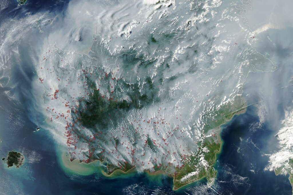
The VIIRS instrument (a camera that sees visible and infrared light) on the NOAA-20 satellite photographed thick smoke covering much of the southern third of the island on October 11. NASA says the pollution has delayed and canceled flights, closed schools and led officials in some areas to urge children and older people to wear masks. Local news outlets report crop failures, water shortages and school disruptions caused by the drought.
“It’s a horrible situation,” said Robert Field, an associate research scientist at NASA’s Goddard Institute for Space Studies and Columbia University. Most of the smoke, he said, stays near the surface, where people breathe it.
Records on one side, third place on the other
The figures come from the Global Fire Emissions Database (GFED), a satellite-based system that estimates how much vegetation burns and how much carbon that releases. Guido van der Werf of Wageningen University & Research, who led its development, said Papua New Guinea’s emissions already exceed the 2015 total for the whole year. He considers it very likely that 2026 will become the highest year on record there, passing 1997.
On the Indonesian side of the island, carbon emissions passed 35 megatons. That is the third highest on record, after 1997 and 2015, which were also El Niño years with severe fires.
Almost all of these fires are lit by people, researchers say, for crop burning, pasture maintenance, land clearing, deforestation and hunting. In normal wet conditions those fires stay small. In the parched landscape some spread uncontrolled, especially in the drier south.
Yang Chen of the University of California, Irvine, said fire activity is exceptionally high in Papua New Guinea and eastern Indonesia, including Indonesian Papua and Kalimantan, compared with Sumatra. He described Papua as Indonesia’s new deforestation frontier. Figures from Global Forest Watch, cited by NASA, put the loss of primary (never-logged) forest in Indonesian Papua at 27,000 hectares in 2025. That is almost twice what was lost in 2024 and the highest annual figure since 2017.
Sumatra is burning less than in earlier drought years, partly because much of it is already developed. Field noted that plantations often keep private fire brigades, so fire concentrates in unmanaged land and the edges of primary forest.
What the satellites can miss, and how this compares with 2015
The record covers carbon released so far, and the season is not over. Researchers expect the fires to continue until the heavy rains typically arrive in the southern part of New Guinea in early November.
Satellite counts also have blind spots. In a separate Earth Observatory story on Indonesian peatland fires, scientists explained that MODIS and VIIRS struggle to see fires through thick smoke, cloud, forest understory and underground peat, so counts can fall just when burning is worst. In its Amazon story, NASA said researchers around Santarém identified about 40 percent more fires than appear in NASA’s active-fire counts. Totals from space are therefore best read as a floor, not a ceiling.
Peat matters because it is dried wetland soil that smolders at low temperatures, sometimes underground, which makes it hard to put out. NASA reported that Indonesia holds about 36 percent of the world’s tropical peatlands, and that peat fires give off about three times more fine particulate matter than other tropical forest fires. Those figures come from a GFED5-based estimate.
The 2015 season is the benchmark. NASA said those Indonesian fires burned for more than three months and released 1.75 billion tons of greenhouse gas equivalents, more than Japan emits in a year. As of September 2 this year, Indonesia’s fires had burned about a month and released roughly 10 percent as much. The New Guinea megaton figures count carbon only, so they cannot be compared directly with that greenhouse gas total. Indonesia’s SiPongi monitoring platform recorded 946 hotspots on August 31.
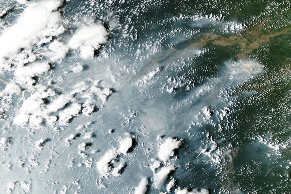
The fires are part of a wider El Niño pattern. NASA describes a cascade of tropical fires that starts in equatorial Asia and moves on to the Amazon, where it reports thick smoke around Manaus and Santarém in October.