Landsat 8 catches Pennsylvania’s Grand Canyon at peak autumn color
A Landsat 8 image from Oct. 25 shows red and gold forest around Pine Creek Gorge, a valley about 1,500 feet deep that was shaped by ice age floods rather than by glaciers.
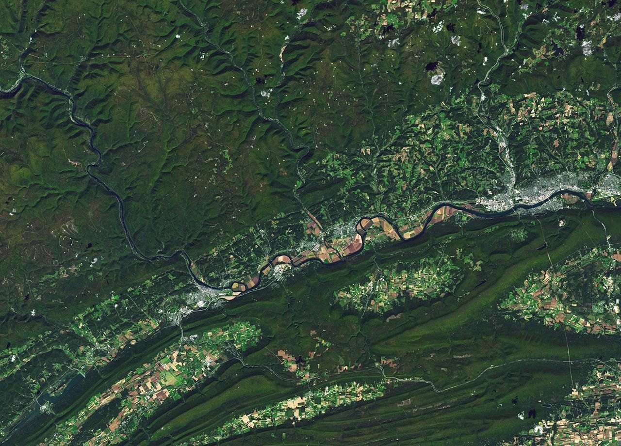
NASA’s Earth Observatory has published a Landsat 8 image of Pine Creek Gorge in north-central Pennsylvania, taken on October 25, 2026, when the forest on the Allegheny Plateau had turned red and gold. The gorge is about 1,500 feet (460 meters) deep.
A canyon with green slopes instead of bare rock
Pine Creek Gorge is nicknamed the “Grand Canyon of Pennsylvania.” Unlike the canyons of the desert Southwest, it has no steep bare cliffs. Its slopes are covered in trees, so the shape of the land shows up in the satellite picture mainly as narrow, curving valleys cutting into a forested plateau.
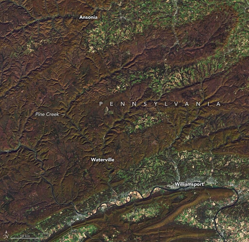
The gorge runs for about 45 miles (72 kilometers) from Ansonia south to the point where Pine Creek meets the West Branch Susquehanna River. It is deepest around Waterville. The hillsides carry northern hardwood and mixed oak forest with some hemlock and white pine, and in autumn the deciduous trees give the landscape the red and gold tones of the Arizona canyon, NASA said.
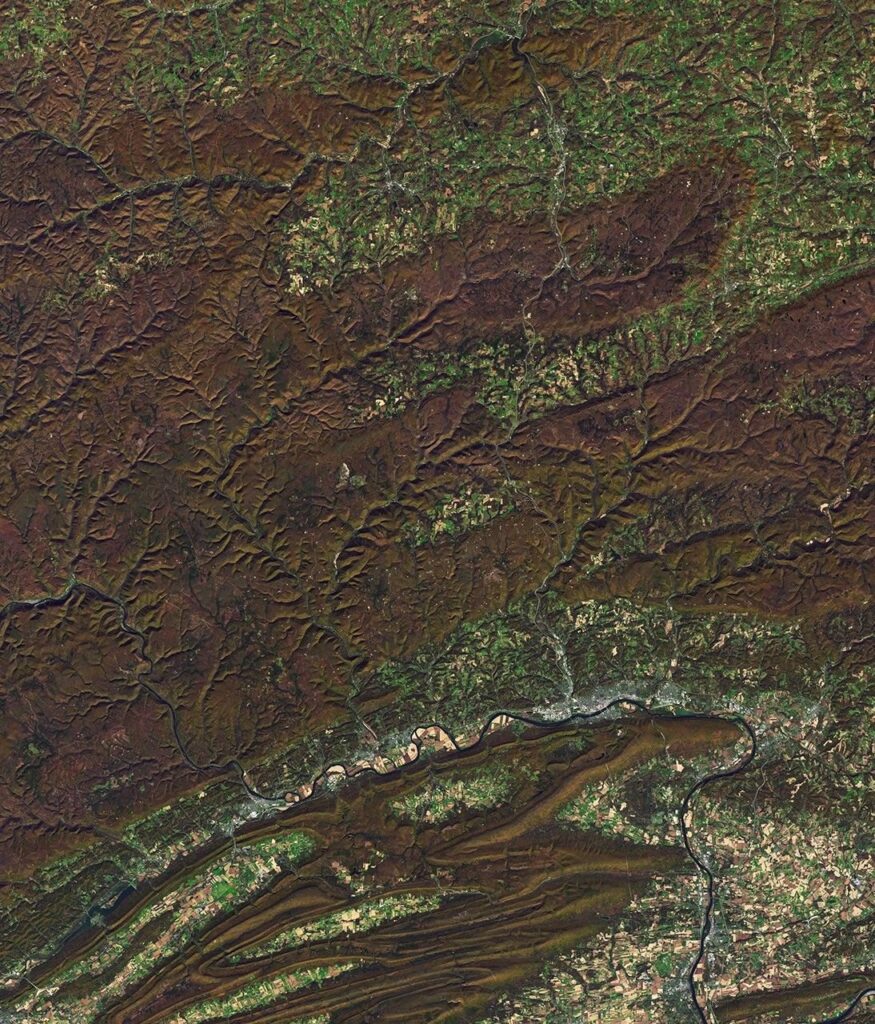
Earth Observatory also paired the image with one from October 9, when the vegetation was still mostly green, so the color change over 16 days can be compared. Both were captured by the Operational Land Imager (OLI), the camera on Landsat 8, and processed by Michala Garrison using data from the U.S. Geological Survey.
Ice dammed the river, and the overflow did the carving
Glaciers shaped the gorge without carving it directly. According to NASA, Pine Creek once flowed north. During the last ice age, glaciers advancing from the northeast blocked the river and filled the valley with lakes. When those lakes overflowed, water ran south instead.
As the ice retreated, the creek was already settling into its southward course. Rocks and sand left behind by the melting ice kept the water from turning back north, and meltwater rushing through the valley deepened it into its present form.
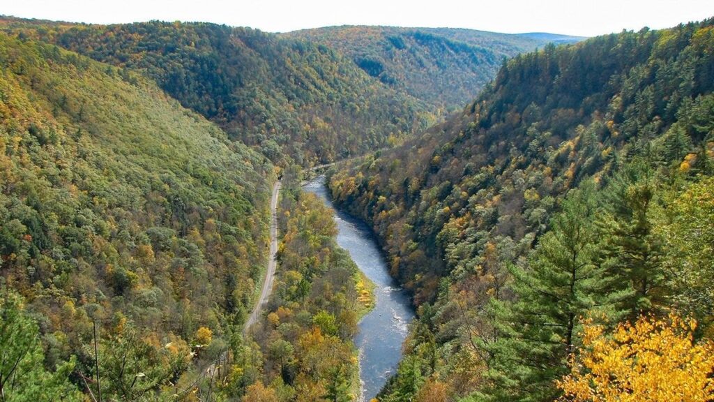
The scenery has not always looked this good. In the early 19th century, loggers took the tall pines, which were prized for ship masts, and hemlock, whose bark was used to tan leather. Logs were floated down Pine Creek to the Susquehanna before railroads arrived. By the early 20th century the land was so bare that it was called the “Pennsylvania Desert.” Since then the forest has regrown, and black bears, coyotes, bobcats, timber rattlesnakes and many kinds of songbirds live there again.
The recovery earned official recognition: since 1968, roughly 12,000 hectares (30,000 acres) around the gorge have held National Natural Landmark status.
Why a satellite suits a fall color check
For anyone planning a trip, the image is a practical aid. Visitors can see the gorge from several state parks and along the Pine Creek Rail Trail, and a view from above shows where color is turning across a large area at once.
Landsat 8 is well placed for that job. According to the U.S. Geological Survey, which operates the Landsat program with NASA, the satellite was launched on February 11, 2013 and flies at an altitude of 705 kilometers (438 miles). Each pass covers a strip 185 kilometers (115 miles) wide, wide enough to take in the whole length of the gorge and much of the surrounding plateau in one scene.
The satellite repeats the same ground track every 16 days, USGS says. That is why the two images here, taken on October 9 and October 25, line up exactly: the satellite passed over the same area at the start and end of one orbital cycle. It also means a single satellite can show a given forest only twice a month, so a cloudy pass can cost a whole cycle of observation.
NASA’s list of sources for the piece includes the Pennsylvania Department of Conservation and Natural Resources fall foliage report for the week of October 22 to 28, the Pennsylvania Geological Survey and the Lumber Heritage Region. The Earth Observatory story was written by Lindsey Doermann.