Rain helps tear apart the ocean’s reflective cloud decks, EarthCARE data show
A new study using ESA's EarthCARE satellite finds rain is a key driver in breaking up the low ocean clouds that bounce sunlight back to space, a process that may add to warming.
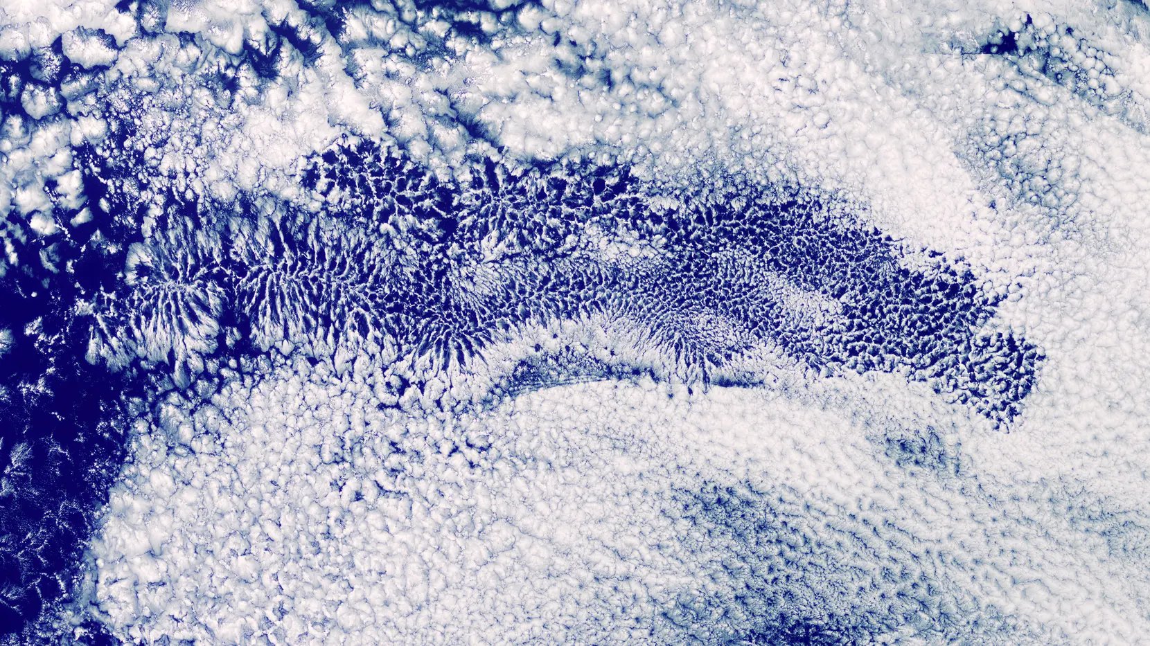
ESA’s EarthCARE satellite has given scientists their clearest look yet at why vast, bright sheets of low ocean cloud break apart: rain appears to be a key driver, according to ESA.
Why a broken cloud deck means a warmer ocean
Marine stratocumulus clouds are low, flat, highly reflective decks that cover large areas of the world’s oceans. They bounce much of the incoming sunlight back to space, which makes them one of Earth’s most effective natural sunshades.
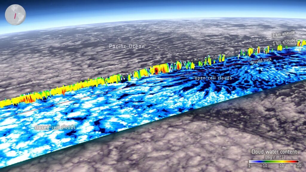
When a deck breaks up, more dark ocean surface is exposed, and the water absorbs far more solar energy than the cloud would have let through. ESA notes that Earth now reflects less sunlight than it used to, leaving an energy imbalance larger than climate models predicted. Recent studies find marine stratocumulus is declining, which is one cause of that drop. Scientists do not yet fully understand why, or whether the trend will continue or speed up as the planet warms.
These clouds have been hard to watch from orbit. They sit close to the sea surface, and earlier spaceborne cloud radars struggled to profile them. EarthCARE can probe their vertical structure and measure droplets, precipitation, how fast droplets fall, and the aerosols (tiny airborne particles) that droplets form around.
From closed cells to open cells
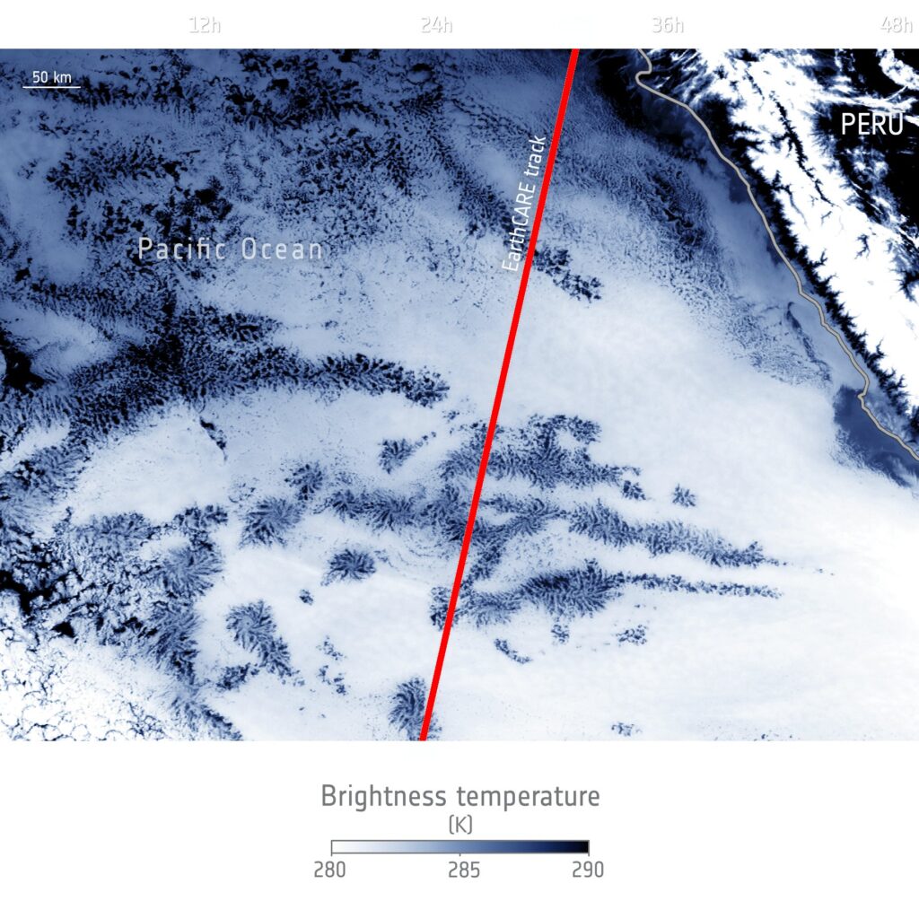
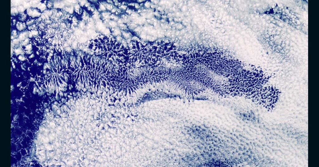
Breakup does not mean the clouds vanish. A continuous deck, known as a closed-cell pattern, can reorganize into a fragmented open-cell pattern with clear gaps between cloud patches. More dark ocean then shows through.
The study behind the finding appeared in the journal Atmospheric Chemistry and Physics under the title “EarthCARE reveals details on the role of rain in closed-to-open cell transitions”, published on 8 October 2026. Its lead author is Johanna Mayer, a research fellow at ESA’s Earth System Science Hub. The co-authors are at ESA’s ESRIN site in Italy and at the European Centre for Medium-Range Weather Forecasts (ECMWF) in the UK.
The team combined two views. Images from a geostationary satellite, which sits above one spot on the equator and keeps pace with Earth’s rotation, tracked how the clouds changed over time. EarthCARE added detailed snapshots of internal structure and rain. The paper names GOES imagery as the geostationary source.
The results support a self-reinforcing cycle that theory had predicted, according to Mayer. Rain strips out aerosol particles, so the remaining droplets have fewer particles to form on and grow larger. Larger droplets make more rain likely, and the cycle strengthens. Eventually it can disrupt the air circulation that holds the deck together, and the cloud opens into cells.
The paper’s abstract adds that open cells have far fewer droplets and heavier, more frequent rain than closed cells, though light drizzle is also common in closed ones. It also says rain amounts and the cloud’s liquid water content rise in closed cells up to 25 hours before a transition.
A radar that can feel raindrops fall
The analysis leans on an instrument that no earlier satellite carried. According to the paper, EarthCARE’s Cloud Profiling Radar is the first spaceborne Doppler radar. A Doppler radar measures motion as well as the amount of water, so it can tell how fast raindrops fall. The paper says combining that with the radar’s reflectivity improves estimates of rain rate and cloud water compared with radars lacking Doppler.
The satellite launched in May 2024, according to the paper, and the study uses data collected between August 2024 and November 2025. That is a short record for a climate question, which is why the researchers lean on the geostationary images to follow each cloud through time. The radar overflies a given spot only about every 25 days, the paper says, so those images fill the gaps between passes.
Mayer’s team links small-scale processes inside single clouds to larger climate changes. Bjorn Stevens, director of the Max Planck Institute for Meteorology, said that applying her methods to the growing body of EarthCARE measurements should improve understanding of the processes governing Earth’s energy budget, and so how fast the world warms.
ESA calls EarthCARE an unprecedented way to study processes inside clouds. The satellite has previously been used to sharpen weather forecasts, and the new work shows its value for climate science too.