NASA will test Planet’s Tanager hyperspectral data over 250,000 square kilometers
Planet Labs won a NASA evaluation order to supply Tanager hyperspectral imagery, which NASA will assess before deciding whether scientists funded by the US government can use it.
NASA has awarded Planet Labs an evaluation task order under its Commercial Satellite Data Acquisition program, under which the agency will test the company’s Tanager hyperspectral satellite data, Planet announced on October 21, 2026.
What NASA will buy and test
The order went to Planet Labs Federal, the company’s subsidiary. NASA will use it to judge the quality, reliability and usefulness of Tanager data for Earth science. It will acquire imagery covering more than 250,000 square kilometers, a mix of archived scenes and newly tasked collections.
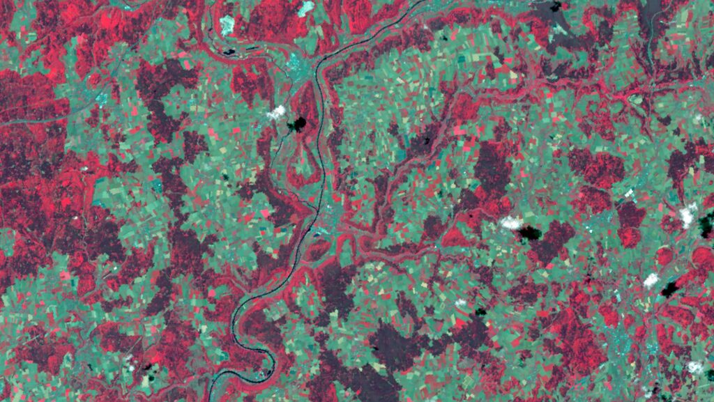
Hyperspectral imaging splits reflected light into hundreds of narrow color bands instead of the few broad ones in an ordinary camera. Each pixel then carries a detailed fingerprint of the material beneath it, such as a gas, a mineral or a type of vegetation. According to Planet, Tanager records more than 400 contiguous spectral channels at 30-meter resolution, so each pixel covers roughly 30 by 30 meters on the ground.
NASA will receive two kinds of product. Level 1C data gives reflectance at the top of the atmosphere, meaning the light as the satellite sees it. Level 2A data corrects for the atmosphere to give reflectance at the surface. Planet lists atmospheric composition, biodiversity, hydrology and geology as focus areas, along with rapid response to wildfires and floods.
When the evaluation ends, NASA will publish a report on data quality and utility. Planet says the report will inform decisions on making Tanager data available to the federally funded scientific community. The award is therefore a trial, not yet a standing purchase. Planet’s Chief Strategy Officer and co-founder Robbie Schingler said that “Hyperspectral data holds immense potential for understanding our changing planet”.
A second satellite, and another agency already checking the first
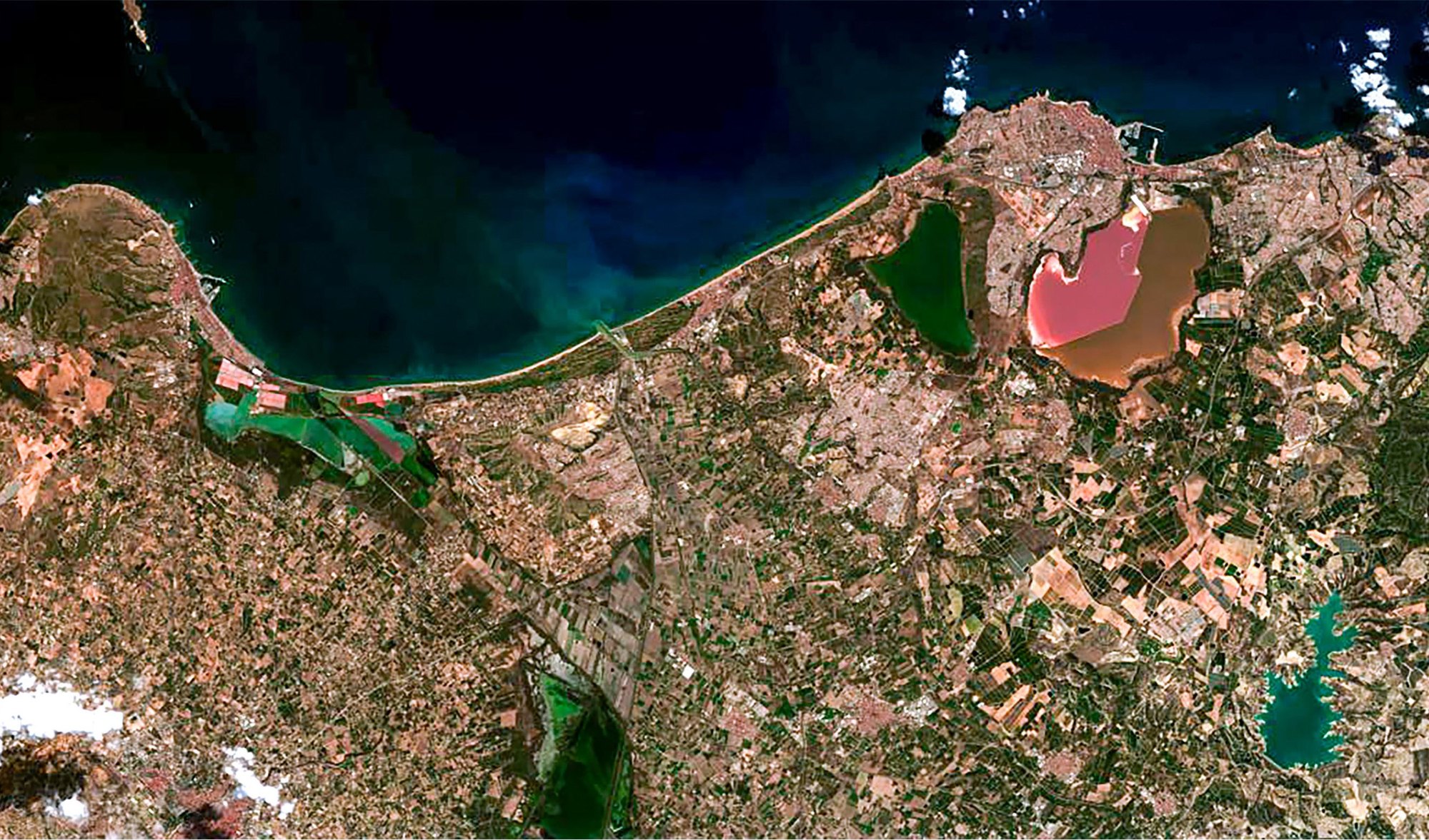
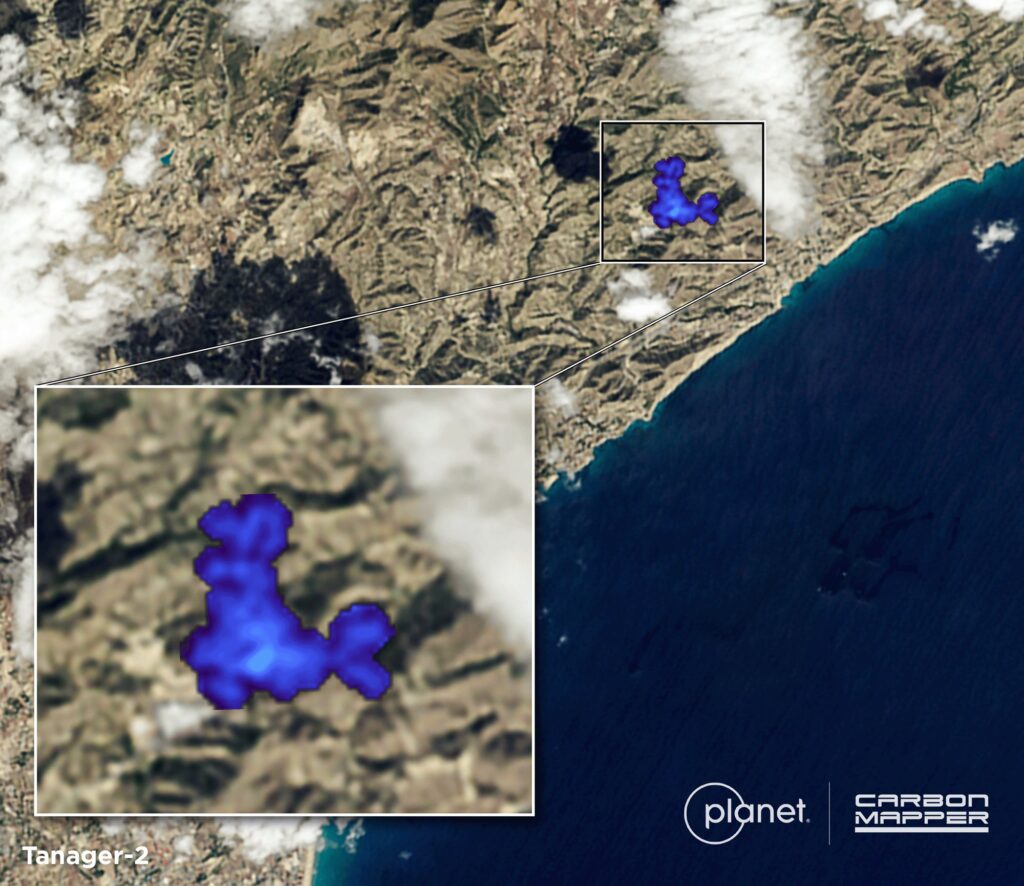
The timing follows a busy few weeks for the program. Tanager-2 launched on October 1, 2026, on SpaceX’s Transporter-18 rideshare mission, according to Planet’s first-light post. Its first image, captured on October 7 over the Pink Lake near Torrevieja in Spain, came six days after launch. Carbon Mapper used data from the same capture to detect a large methane plume over Spain’s coast. Planet says Tanager-2 will roughly double its hyperspectral monitoring capacity and that it plans at least three more Tanager satellites.
NASA is not the first US agency to scrutinize the data. The US Geological Survey (USGS) is separately evaluating the constellation’s on-orbit performance and calibration accuracy. Planet has also opened access through OpenSTAC and launched the Tanager Open Data Competition for researchers and developers.
Why scientists care whether the numbers hold up
The test matters because a hyperspectral instrument is only useful if its measurements are trustworthy to a very fine degree. USGS findings on Tanager-1, summarized by Planet, give a sense of the bar. Spectral channels were off by less than 1 nanometer when checked against an oxygen absorption feature, on bands about 5 nanometers wide. The bands lined up with each other to about a tenth of a pixel. Compared with Landsat, Tanager pixels fell less than half a pixel apart, roughly 6 to 12 meters.
Those are the properties that decide whether researchers can compare scenes from different dates or different satellites without reworking them. Tanager’s spectrometer descends from NASA Jet Propulsion Laboratory designs, including the AVIRIS series and the EMIT instrument on the International Space Station, according to the same post. Planet adapted its radiance processing from open-source EMIT code, and related documents were co-authored with JPL. NASA’s test therefore checks a commercial product built on methods its own scientists know well.
For researchers, the draw is a stream of data that a single government mission cannot supply. Tanager-1 grew out of the Carbon Mapper coalition, which aims to find and track large methane and carbon dioxide sources. Carbon Mapper reports 14,400 published methane plumes between September 19, 2024 and August 16, 2026. A second satellite adds revisit opportunities, while a NASA report would give agencies and universities an independent basis for citing the data in funded work.
Planet’s Pelican-12 satellite, which reached orbit on October 20, belongs to a different product line of sharper optical imagery. The Tanager work shows the company pursuing government science customers with measurements of what the surface and air are made of, rather than only pictures of how they look.