Sentinel-3C sees Hurricane Rachel in its first temperature-radiometer image
ESA's newest Earth-observing satellite has imaged Hurricane Rachel off Mexico, showing that the visible channels of its temperature radiometer work. Thermal images are still to come.

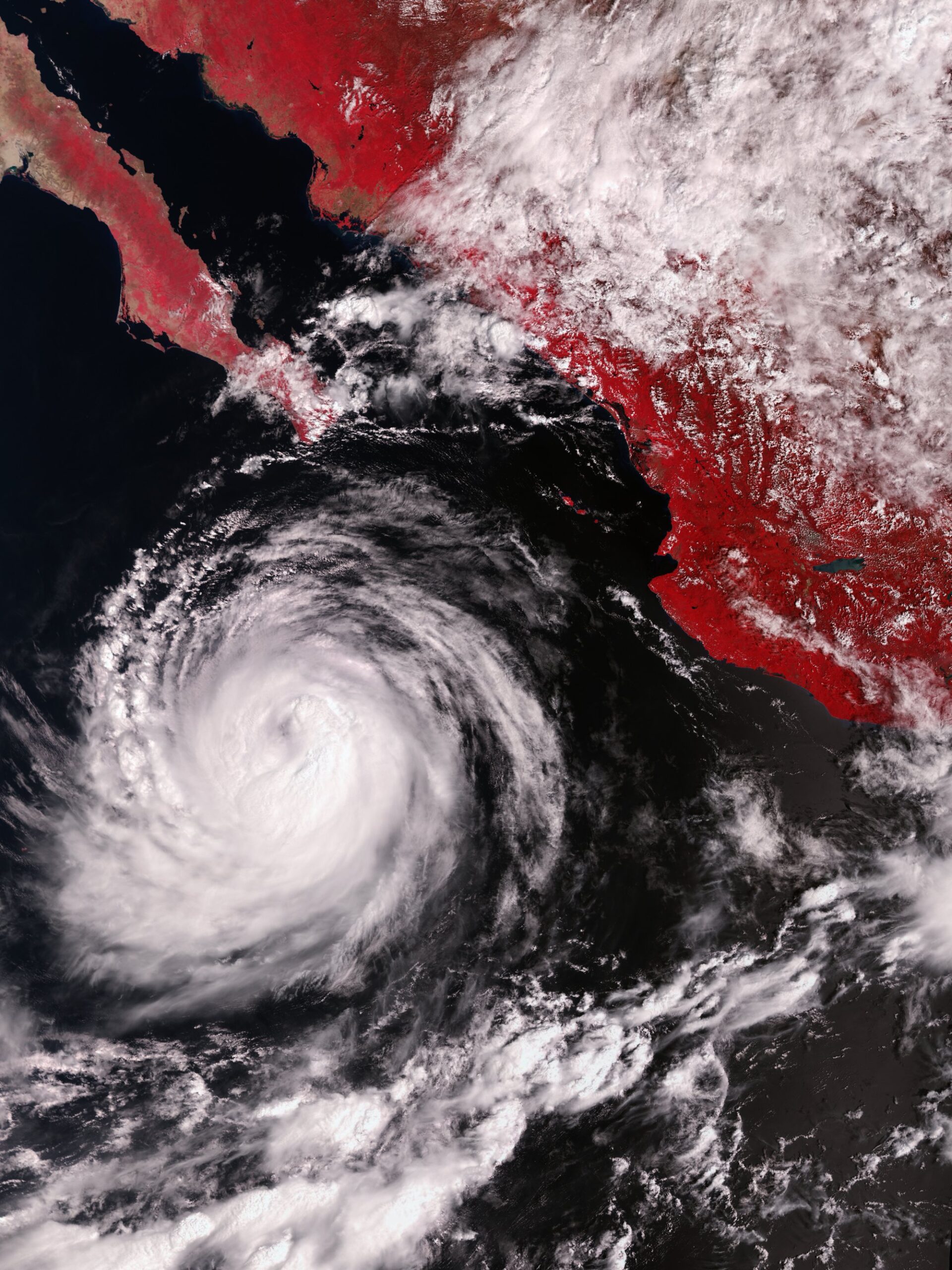
The European Space Agency’s newest Earth-observing satellite, Sentinel-3C, has photographed Hurricane Rachel over the eastern Pacific. The 2 October image shows the visible channels of its temperature-measuring radiometer working as expected, ESA said.
ESA published the picture on 19 October in its image library. It shows the storm off the coast of Mexico and the Baja California Peninsula. ESA calls it another milestone in commissioning, the testing period in which a new satellite is checked and calibrated before it enters regular service.

A storm seen through a temperature instrument
The instrument is the sea and land surface temperature radiometer, which records the light and heat coming from Earth in nine bands of the spectrum. They run from visible light through shortwave infrared to thermal infrared. It also has two dedicated channels for detecting fires.
Its main job is to measure the temperature of the sea and land surface using the thermal infrared channels. This first picture comes only from the visible channels, so it looks like a photograph. It is a false-colour image, meaning the colours are assigned to the bands rather than matching what the eye would see. Vegetation on land therefore appears red.

The visible channels still matter for the temperature work. ESA said they detect clouds so that cloud tops are not mistaken for the ground or sea surface and do not contaminate the temperature readings. They also help estimate aerosols, the tiny airborne particles in the atmosphere, and correct for the effect of the atmosphere on the data. A hurricane is a demanding test, because it is a large, bright and complex mass of cloud.
ESA said images from the thermal channels are still to come.

The third Sentinel-3 satellite, a month into its life
Sentinel-3C is the third satellite in the Copernicus Sentinel-3 series and was launched on 15 September, according to ESA. Copernicus is the European Union’s Earth observation program. Like its older siblings, the satellite carries instruments that systematically measure the oceans, land, ice and atmosphere.
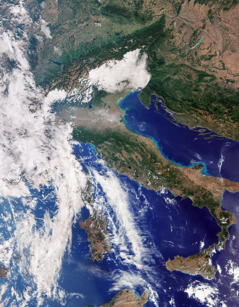
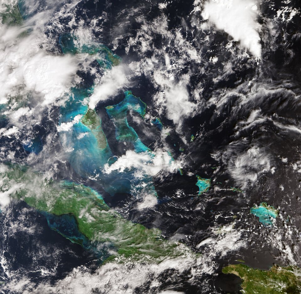
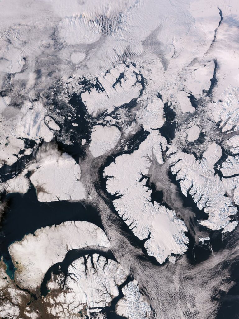
Two other instruments have already returned data. In an earlier ESA report, the ocean and land colour instrument delivered natural-colour views of Italy and the Alps on 30 September, part of the Canadian Arctic Archipelago and an area of the Caribbean around Cuba and the Bahamas. The radar altimeter, which measures the height of the sea surface and of ice, produced sea-level measurements across the Atlantic and Mediterranean. ESA compared these with the Copernicus Marine Service’s multi-mission sea-level product and said the instrument is performing well.
The same report said the altimeter’s tracks over the Greenland ice sheet, recorded between 30 September and 4 October, closely match a reference elevation model. ESA also said commissioning would take about five more months before the satellite enters full service.
What a fuller instrument set means for users on Earth
With three satellites in the series, the surface-temperature measurements and the sea-level, ocean-colour and ice data that Sentinel-3 provides can be gathered more often. These data feed the Copernicus Marine Service, which ESA used as the reference for checking the new altimeter, and they help scientists following ocean conditions, ice and vegetation on land.
Hurricane Rachel is an example of what the visible channels can add. Storms like it form over warm water, so surface temperature is a key measurement for studying them. The thermal images that ESA says are coming will be the ones that capture that heat. The visible channels’ cloud detection is what keeps those temperature readings clean.
ESA’s picture library includes earlier Sentinel-3 views of Hurricanes Otis, Milton and Melissa, so the series has a track record of capturing major storms.
ESA gave no date for the first thermal images, only that they are to follow as commissioning continues.